
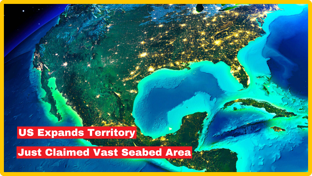
US Expands Territory by 1 Million Square Kilometers as It happened without a treaty, without congressional approval, and without much public fanfare – yet it may stand as one of the most consequential territorial expansions in American history.
The United States has officially added more than one million square kilometers to its sovereign domain through a landmark US Extended Continental Shelf claim, announced by the State Department in December 2023 and continuing to generate significant geopolitical and economic discussion into 2026.
The addition — an area roughly twice the size of California, or nearly 60 percent the size of Alaska — does not add new land above water. Instead, it grants the United States exclusive rights over vast stretches of ocean floor stretching far beyond its existing coastal boundaries.
The addition of this vast territory significantly strengthens the nation’s control over marine resources. “America is larger than it was yesterday,” said Mead Treadwell, a former Alaska lieutenant governor and former chair of the U.S. Arctic Research Commission.
“It’s not quite the Louisiana Purchase. It’s not quite the purchase of Alaska, but the new area of land and subsurface resources under the land controlled by the United States is two Californias larger.”
What Is the Extended Continental Shelf?
To understand why this claim matters, it helps to understand the legal and geographic concept at its core.
Under international law, coastal nations that can prove their seabed naturally extends beyond the standard 200-nautical-mile limit gain control over everything on and beneath the ocean floor. This zone is known as the Extended Continental Shelf, or ECS.
Think of it this way: every coastal country owns a kind of underwater “basement” that extends outward from its shoreline. International law typically sets the boundary of that basement at 200 nautical miles from the coast. But when the geology of the seafloor demonstrates that a nation’s landmass continues naturally beneath the water beyond that point, the country can claim rights stretching further — in some cases, up to 350 nautical miles or beyond.
The U.S. now has the right to control and potentially exploit resources like oil, gas, and minerals in the expanded territory. However, it doesn’t mean the U.S. can suddenly start fishing further off the coast or start patrolling the new water regions. It is more like the U.S. government won the mineral rights to some underwater property.
Crucially, this declaration does not extend U.S. jurisdiction over the water column or fishing rights beyond 200 miles off its coast. Instead, it focuses on control over the seabed and its resources, including mining and research rights, as well as pipeline activities.
Two Decades of Science at Sea
The US Expands Territory claim did not emerge overnight. It was the product of one of the most ambitious geological mapping programs in American history – a multi-agency effort spanning more than two decades and involving some of the world’s most sophisticated oceanographic technology.
The territory expansion process was a collaborative effort led by the U.S. State Department, NOAA, and the U.S. Geological Survey. It involved 20 years of comprehensive geological data gathering, including extensive fieldwork and 40 missions at sea, to determine the outer limits of the U.S. continental shelf.
State Department Project Director Brian Van Pay offered a vivid account of the scale of the undertaking. Van Pay said it took multi-agency fieldwork spanning 20 years for scientists to gather data about the shape of the seafloor and measuring sediment layers. “Forty missions at sea, going to areas that we’ve never explored before, finding entire seamounts we didn’t even know existed,” Van Pay noted. NPR
NOAA mapped more than three million square kilometers of seafloor in U.S. coastal areas during the project, an area larger than Alaska, California, and Texas combined. The effort also determined the precise depth of the Challenger Deep, the deepest spot in the ocean, at 10,994 meters. Scientists also discovered the Cape Fear submarine landslide, a 375-kilometer-long underwater avalanche and the largest ever documented off the U.S. east coast.
“We’ve established the limits of the U.S. continental shelf, and it’s now up to us to explore, learn new science, and then steward, manage, and help preserve these areas for future generations,” said Barry Eakins, a marine geophysicist who led the CIRES ECS team at NOAA.
Where Does This New Territory Lie?
The areas encompassed in this claim include the Arctic, the east coast Atlantic, the Bering Sea, the west coast Pacific, the Mariana Islands, and two regions in the Gulf of Mexico. More than half of the newly claimed territory lies in the Arctic – a region of rapidly growing strategic importance as climate change continues to open new shipping routes and expose previously inaccessible natural resources.
The claim has been carefully drawn to avoid diplomatic conflicts where possible. The State Department’s Arctic claim notably aligns with a 1990 maritime boundary agreement with Russia, ensuring no encroachment on Russian territory. “None of the fixed points delineating the outer limits of the continental shelf of the United States are located west of the agreed boundary with the Russian Federation,” the State Department confirmed.
However, potential complications with Canada have already been flagged. Potential overlap with Canada’s claims was acknowledged by Van Pay, indicating future diplomatic negotiations may be necessary.
The UNCLOS Problem: A Claim Without Formal Treaty Status
One of the most unusual aspects of this territorial expansion is the legal framework – or more precisely, the gap within it.
The United States spent nearly two decades and more than $100 million collecting geological data to define its ECS limits using the exact formulas laid out in the United Nations Convention on the Law of the Sea. Then, in December 2023, the State Department simply announced those coordinates without submitting them to the UN commission for review, as treaty members must do.
The U.S. has never actually ratified UNCLOS, even though it played a significant role in drafting it back in the 1970s and 1980. Worries about sovereignty, naval operations, and financial commitments have created major roadblocks to Senate ratification. Even though the U.S. is not a formal party, it already follows many of the convention’s rules, using its provisions to back up territorial claims and assert navigation rights in international waters.
“It was a very unconventional and surprising move,” Rebecca Pincus, director of the Polar Institute at the Wilson Center, told Radio Free Europe. “The U.S. has claimed a million square kilometers of territory, which is great, but we have done so in a way that raises some questions about international law.”
Without formal UNCLOS ratification, the legal enforceability of the claim in international dispute forums remains an open question — one that could become more pressing as competing nations pursue their own Arctic and deep-sea resource strategies.
What Resources Are at Stake?
The economic implications of the US Extended Continental Shelf expansion are substantial, particularly in the context of global energy markets and the emerging deep-sea mining industry.
It is estimated that the Bering Sea in the northern U.S.-Russia maritime border holds around 126 trillion cubic feet of natural gas and more than 24 billion barrels of oil. U.S. authorities can also benefit from extended jurisdiction over seabed resources as deep-sea mining gains popularity, with deep-sea mining companies having found large reserves of critical minerals.
Beyond fossil fuels and critical minerals, the expanded territory also opens new frontiers for scientific research, undersea pipeline rights, and long-term environmental stewardship of some of the planet’s least explored ecosystems.
Geopolitical Significance in 2026
As Arctic ice continues to recede, the strategic significance of the US Extended Continental Shelf claim only deepens. Competing territorial assertions from Russia, Canada, Norway, and Denmark — among others — have turned the Arctic into one of the most contested geopolitical spaces on Earth. The U.S. claim, covering more than half its new territory in that region alone, positions America as a major stakeholder in whatever international governance frameworks emerge for the High North in the years ahead.
The Trump administration’s continued interest in expanding American resource extraction and maritime dominance – including its repeated references to Greenland and the Arctic more broadly — has given this previously quiet bureaucratic announcement renewed political salience in 2026.
Conclusion
The United States’ one-million-square-kilometer US Extended Continental Shelf expansion is a landmark event in American territorial history — one that unfolded through science and legal interpretation rather than war or purchase. It grants the U.S. sovereign rights over enormous stretches of seabed rich in oil, gas, and critical minerals across seven ocean regions.
While the legal standing of the claim is complicated by the Senate’s longstanding refusal to ratify UNCLOS, the scientific rigor behind it and its careful alignment with existing bilateral agreements give it considerable weight. As the Arctic opens further and deep-sea resources grow in strategic importance, this quiet expansion of American territory may prove to be one of the defining geopolitical moves of the early 21st century.
Given the vast natural resources and strategic value of the newly claimed seabed territory, do you think the U.S. Senate should finally ratify the UN Convention on the Law of the Sea to strengthen America’s legal position — or would that compromise too much national sovereignty?
Frequently Asked Questions (FAQ)
Q1: What exactly did the United States claim in its Extended Continental Shelf expansion?
The U.S. claimed sovereign rights over more than one million square kilometers of ocean floor — an area roughly twice the size of California — spread across seven distinct offshore regions. These include parts of the Arctic, the Atlantic Ocean off the East Coast, the Bering Sea, the Pacific Ocean off the West Coast, the Mariana Islands, and two areas in the Gulf of Mexico.
The claim grants the U.S. exclusive rights over the seabed and its resources, including oil, gas, minerals, and subsurface pipeline routes, but does not extend fishing rights or jurisdictional control over the water column above.
Q2: Does the U.S. have the legal right to make this claim if it hasn’t ratified UNCLOS?
This is the central legal question surrounding the claim. The U.S. used the scientific methodology outlined in the UN Convention on the Law of the Sea — a treaty it helped draft but never formally ratified — to calculate and announce its ECS boundaries. Because the U.S. is not a formal party to UNCLOS, it did not submit its claim to the UN Commission on the Limits of the Continental Shelf for review, as treaty members are required to do.
Legal experts are divided on the enforceability of the claim in international dispute forums, though the scientific depth behind it and its alignment with existing bilateral agreements with Russia lend it considerable practical credibility.
Q3: What natural resources does the newly claimed territory contain?
The expanded territory is believed to hold enormous quantities of natural resources. The Bering Sea portion alone is estimated to contain approximately 126 trillion cubic feet of natural gas and more than 24 billion barrels of oil.
The claim also opens the door to deep-sea mining of critical minerals – including rare earth elements and metals used in battery technology and electronics manufacturing – as well as new opportunities for undersea pipeline infrastructure and scientific exploration of some of the world’s least-studied ocean ecosystems.


Be First to Comment